![]()
![]()
![]()
![]()
![]()
![]()
![]()
![]()
![]()
![]()
![]()
![]()
![]()
 Heritage
Trail Traveler's tips: The complete itinerary is 75 miles. The route as described below begins and ends in Claremont and is presented in a roughly counter-clockwise direction. You could just as well do all or some of it in reverse and, of course, choose to concentrate on certain sections depending on available time and inclination. Because of the scale of the trail map it's probably wise to set out with a good road map or atlas close at hand. Mileages are given here and there to help you gauge your progress. Some of the unpaved road sections in this itinerary may present a challenge for some vehicles in the winter and during mud season. Within this text you'll find live links that shed light on the architecture and history of the many buildings you'll encounter that are listed on the National Register of Historic Places. After visiting these pages, use your browser's back button to return to the trail guide. Properties listed on the National Register are noted by NR and National Historic Landmarks by NHL. Many of the sites included in the itinerary are privately owned and not open to the public. Please respect their owners' privacy.
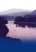
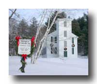
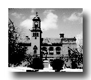
CLAREMONT (Settled 1762; 1990 population:13905). Named by Gov Benning Wentworth to honor his cousin, Lord Clare, whose English estate in Surrey was named Claremont Castle. Sullivan County's only city, Claremont was first settled by Moses Spafford and David Lynde, two Connecticut grantees. The oldest areas are west of downtown Claremont whose early development was tied to the water power potential of the Sugar River and along which textile, paper and machinery mills were built, many of which remain today. The river--it's total fall through the town is 250 feet--flows from Lake Sunapee emptying into the Connecticut at West Claremont. Although Claremont is best known for its industrial heritage, in the mid-1800s it enjoyed the reputation of being the best farming town in New Hampshire. We continue on our walking tour by passing the City Hall and stopping to survey the scene of Broad Street Park, which the City Hall and a number of other distinctive and historic Claremont buildings overlook. In the center of the park is the Band Stand (1890), two Civil War cannon, and the Soldiers' Monument (1890), designed by Martin Milmore, a contemporary of Saint-Gaudens and responsible for many of the Civil War statues seen throughout New England. From the park look back towards Tremont Square and you'll see Mt Ascutney in the distance, framed by the two church steeples. To the northeast, opposite the City Hall, is the Georgian Revival Central Fire Station (1917) with its artistic assemblage of firefighting motifs in the second floor arch; and on the corner of Broad and Chapel, the Fiske Free Library (1903), built of stone in the Classical Revival style. Between the two is the Universalist Church (1832), now the Claremont Conference Center, which originally was Federal in style. In 1836 it was remodeled to Victorian Gothic with a touch of what's known as 'stick-style.' Behind it and the library is the Old Burying Ground. On the other corner of Chapel Street is Trinity Church (1852-53) which is stick-style personified and one of the best examples in the region. A corner tower came down in the 1938 hurricane and was never replaced. The next building going south on Broad Street is the Charles Goodwin Community Center (1885-86). Walk west on Pine Street which enters Broad Street opposite the Post Office (1931), past the brick Farwell Building (c. 1830) on the corner and its neighbor which was once the town clerk's office. We're soon at Pleasant Street and the First Congregational Church (1835-36) which was built to replace the 1785 meetinghouse (which, in turn, became the town hall, later replaced by the present City Hall). Built of brick, its pointed arched windows suggest the Gothic Revival style. The church's wooden two-stage crenellated bell tower is perhaps its most unusual and distinctive feature. Turning the corner we proceed along Pleasant Street back to Tremont Square. Both sides of this stretch are lined with mostly late 19th- early 20th- century commercial buildings. This single block and Tremont Square were the heart of Claremont up until the 1950s. Notice the cast iron columns of Rand's Block (1871) at 34-42 Pleasant Street. Probably the most interesting of the commercial buildings in this grouping is the Union Block (1888-89) on the west side at the corner of Sullivan Street at Tremont Square, a three-story brick, brownstone and terra cotta Queen Anne style building with elaborately intricate brickwork along its cornice. Across Sullivan Street, and defining the western edge of Tremont Square, is the Bailey Block (1826) which also incorporates decorative brickwork. The third floor was added in 1878 to serve as the town's library, the sign for which remains. Just west on Sullivan, at the corner of Franklin Street, is the solid and restrained United Methodist Church (1929), a late Gothic Revival style church built of rubble stone. This completes our short circular tour of the Downtown Historic District. You may wish to continue, by foot or car, into the adjoining Lower Village Historic District (NR). If so, go west along Main Street as it leaves Tremont Square. This brings us into the area between what was called "The Plain" and the banks of the Sugar River where Claremont's industrial heritage was born and prospered. The two chief industries were the Monadnock Mills and the Sullivan Machinery Company. Buildings of both survive on either side of the Sugar River. Among the more significant sites in this historic district are the handsome Sugar River Mill (1855) at 159 Main Street beside the river, now elderly housing, and the numerous connected buildings of Monadnock Mills (1836-1910, NR) stretching along Water Street; the brick Greek Revival-style First Baptist Church (1833-34) on the corner of Main and Central Streets; and the neighboring Victorian Gothic-style St Mary Roman Catholic Church (1870) on Central Street. (The latter replaced the first St Mary's which still stands in West Claremont and has the distinction of being the state's oldest Catholic church building.) Opposite the church stand three brick Greek Revival mansions (1835-36), originally the homes of the pioneering Claremont industrialists, Ormond Dutton, Simeon Ide and Henry Russell. The house of the fourth, Charles Putnam, no longer survives. Now owned by the Catholic Church, they are believed to have been the work of the prolific Walpole master builder, Aaron Howland. Once you've seen some of the highlights of downtown Claremont, begin the driving itinerary by leaving Tremont Square, going past the City Hall, circling Broad Street Park and going north, across the Sugar River (have a last look back at the mill complex along its banks). Follow the signs for Rt 120, a two-lane state highway which takes us into the neighboring town of Cornish. As we proceed the landscape becomes more rural and heavily wooded. In just over six miles look for an unpaved road going off diagonally to the left. Make this turn which leads us past Edminster Cemetery, a well-cared for and attractively sited burying ground. Fronted by a white picket fence and laid out on terraces, it has several hundred markers of granite, marble and slate, including those of 9 Revolutionary War soldiers. The view from here westward is lovely, Mt. Ascutney in the distance, framed by nearer hills. Throughout our itinerary views of this fabled mountain will appear. Continue on a few hundred feet to Jackson Road (paved) and take a left. We pass on the right a handsome brick house (1797) in a pretty setting and at mile 8 we join Brook Road, unpaved, which in a mile takes us to Town House Road (paved) where we bear right and head north. Soon after we'll see on the right the Blacksmith Shop Covered Bridge (also known as Kenyon Hill bridge, 1881, NR). Although no longer in use, we can still enjoy the scene despite the challenge of nearby parking. Spanning Mill Brook, it was built by James Tasker--a name we will keep encountering on this itinerary--and restored in 1963. It employs a multiple kingpost truss design. The name comes from bridge's proximity to a blacksmith shop that once stood nearby. At mile 10 we find ourselves in Cornish City, a curious name for a crossroads village comprising not much more than the Cornish Town Offices and Cornish Grange No 25 (1842), a brick Greek Revival single story building with an attractive columned recessed entranceway. Built as a Congregational church it later was taken over by the Methodists and then, in 1917, by the Cornish Grange, which, in turn, donated the building in 1994 to the town for offices. The original two-stage tower was removed in 1961.
CORNISH (Settled 1765; 1990 population: 1659). Although the early settlers in Cornish were chiefly from Sutton, Massachusetts, they were preceded by procurors of white pine for masts for the Royal Navy. This explains the original name of "Mast Camp." The namesake for Cornish is Admiral Sir Samuel Cornish. With little question Cornish's--and to a lesser extent, Plainfield's--fame lies in its association with that remarkable assemblage of residents and visitors known as the Cornish Colony. The heyday of the Colony was between the 1880s and early 1930s when a group of artists, writers, musicians and cultural movers and shakers in general flocked to the area for its scenery and pace of life and for the opportunity to get away from the city and congregate with their own kind. The central figure was the sculptor Augustus Saint-Gaudens whose home and studio are on this itinerary. Many often elaborate houses were built by the Colonists of which numerous remain although usually not visible from the road. Cornish still draws the artistically inspired, the most famous today being the reclusive writer, J. D. Salinger. Returning to the junction of Center and Town House Roads, take a right onto Center Road, heading north. This route follows Mill Brook eventually bringing us to Cornish Center at mile 12.5. On the north side of the road stands the United Church (1841-42). It shows the influence of Ammi Burnham Young, the Lebanon architect who designed other Greek Revival buildings at nearby Kimball Union Academy and at Dartmouth College and was responsible for the Custom House in Boston. The present congregation dates from 1954 when the Baptists and Congregationalists united together. The small brick building just to the west is the Vestry. The former parsonage is the white hilltop house further to the west. Take a moment and walk up to the small though beautifully situated Center Cemetery which is just up the hill behind the church. Continuing eastward on Center Road, we arrive back at Rt 120 at mile 14.3. Make a left turn and proceed one mile northward into Cornish Flat. As we approach, note on the left the large hip-roofed brick Leavitt-Spaulding House (c.1800), the grandest house in Cornish Flat, the largest of the town's numerous small villages. The triangular green with its granite Civil War statue (1890), Rolls of Honor and fenceless granite posts is flanked by several interesting and attractive buildings, the most prominent being the white clapboarded, three-door First Baptist Church (1803, NR). Originally located near Cornish Center, it was moved here in 1818. Over the years substantial changes have been made to the building and although it is no longer a functioning church (its referred to as the Meeting House and is used just for that, meetings) it nonetheless remains today as the focal point of the village and the home of the Cornish Historical Society. On the east side of Rt 120, particularly along School Street, are several houses and sites worth having a look at. Two buildings in from Rt 120, on the south side, is the Colonial Revival-style George H. Stowell Free Library (1910) named for a local son whose donation covered the cost of construction, followed by the tiny single story brick Records Building (1886), built for $800 as the repository for town records and to accommodate the selectmen's office. The annex was added in 1895 and served as the town's "lock-up" for many years. Although the 'Steam Fire Proof' safe remains, the building--now owned by the Cornish Historical Society--has been vacant since the town functions moved in 1995 to the Town Offices in Cornish City. A bit further on stands what was the Cornish Flat School until 1955 and is now the Cheshire Lodge No 23, the Masonic Temple. Notice the decorative "bargeboards" on the eaves of the house next door. Across the road is the Cornish Flat Cemetery which has no fewer than 16 graves of Revolutionary War veterans. Immediately to the east is the Park Grange No 249, a single story brick building originally a residence. We return to Rt 120 but if we had continued along School Street we would have come eventually to one of the entrances to Corbin's Park, more formally known as the Blue Mountain Forest Association. Established in the 1880s as a private game park, its forty square miles spreads over five towns. It was from Corbin's that a national movement to save the American Buffalo was launched, the park's herd being used to resupply animals for buffalo reserves in the west. The Park still continues today as a private shareholding hunting club. From Cornish Flat we turn north on Rt 120, passing through a scenic agricultural landscape of open fields and pasture, soon crossing into the town of Plainfield. On the right just before Stage Road enters from the west is an unpaved drive, Andrews Lane, that goes into the Moulton-Yard Cemetery, quite a pleasant burying ground. At mile 19.7, at the Main Street intersection, you'll see the brick Baptist Church (1836) on the northwest corner. Next to the church is the Elias Frost House, (c. 1808); Dr Frost agreed to part with his garden to provide the site for the church. Taking a left onto Main Street we gradually climb through the village of Meriden, a hilltop settlement set off as a parish of Plainfield in 1780. Dominating the village is the campus of Kimball Union Academy. It was chartered in 1813 "to train young men for leadership in the ministry" and to serve as a preparatory school for Dartmouth College. A number of the historic houses along this stretch are now owned by the Academy, among them the fine brick Levi Bryant House (now Kilton House, 1825) on the south side and the two somewhat similar brick houses on the north side, Chellis House (1837) and Hazelton House (1810). The major school buildings are near the top of the hill: Among the more interesting are the diminutive stone Barnes Library (1924) with its classical columned temple front and domed cupola, and Baxter Hall (1892), the brick building at the corner of Chellis Road, memorable for its rounded brick corner with belltower above. Across the way at the head of the green is the Meriden Congregational Church (1899), a stone Romanesque Revival style building with a decidedly English feel to it. It's the third church on the same site and replaced the 18th century frame church that succumbed to lightning in 1894. Behind the church are horsesheds and beyond is the two-story galleried Monroe House (c. 1856) which now serves as the headmaster's residence. As you leave Meriden, going west on Brook Road, notice the fine view of distant Mt Ascutney to the southwest. Just a short distance further along on the north side is the entrance to the Helen Woodruff Smith Bird Sanctuary, the first such preserve in America, established in 1910 by Ernest Harold Baynes, whose bronze portrait relief is mounted on a rock not far from the entrance. Paths wind through the woods past numerous birdhouses and birdbaths, some carved from solid rock. The site has strong associations with the 'Cornish Colony.' The still-active Meriden Bird Club maintains the sanctuary. Soon after stands the Meriden Town Hall (1896). Descending along Brook Road, we take a left at mile 20.8 onto Colby Hill Road at Mill Hollow, immediately passing over Bloods Brook on the Meriden Covered Bridge (1880, NR). This 80-foot bridge was built by James Tasker who also was responsible for the Blacksmith Shop bridge (indeed, for all covered bridges on our itinerary). It likewise employs a multiple kingpost truss design. Shortly after the bridge, on the left, is the attractively situated Mill Cemetery which is well worth a stop. About halfway in stands a granite obelisk surrounded by a green cast-iron fence, the grave of Daniel Kimball, founder of Kimball Union Academy. As we climb Colby Hill we pass between two early houses, one noted as dating from 1794. From here the views back toward Meriden are lovely. At this point Colby Hill Road becomes unpaved and changes its name to Ladieu Road and continues to climb through woods. Once over the hill there are more good views, this time toward Vermont. Just before rejoining Brook Road at Pratts Corners we pass another cemetery-- Coreyville --on the left. Buried here is Hodges Cutler, the last to survive of Plainfield's Revolutionary War soldiers. A sharp right turn just after takes us to Brook Road, where we turn left and continue northwesterly alongside Bloods Brook until we reach Route 12A in the very southwestern corner of Lebanon. At mile 26.6 this is the northernmost portion of our itinerary. Proceed south on 12A, back into Plainfield. At mile 28.3 make the right onto River Road, a lovely untrafficked drive that runs beside the Connecticut and offers some very nice views. At the outset are several noteworthy farms, some with farmstands: Edgewater Farm with its early white clapboarded cape farmhouse, followed by Riverview Farm and the McNamera Dairy. Shortly after the latter, on the east side of the road, is River or Colby Cemetery , a small burying ground with some early slate markers. Further on is the Home Hill Country Inn (1818) on the left. This brick Federal style house replaced an earlier tavern that burned. River Road now takes us through some dense groves of pines and hardwood trees that give us an idea of what the wilderness must have been like in the days before settlement. At mile 33.5 we turn left away from the river on Ferry Hill Road. Soon after we rejoin Route 12A. We turn to the north but first look right to enjoy the view of Mt Ascutney. As we proceed north and pass Freeman Road on the left notice, if the trees are bare, a yellow house on the west side of Freeman Road. This is the second and last home of Winston Churchill. The then-famous American author and 'Cornish Colonist' moved here when his grander house, Harlakenden--which for a time was Woodrow Wilson's summer White House--burned in 1923. Also nearby and off Freeman Road is The Oaks, artist Maxfield Parrish's house and studio. The house--featured in some of his famous paintings--burned in 1979 but the studio survives. Shortly after Freeman Road, we turn right onto quiet and unpaved Mill Road which leads us south, across the Cornish townline and through the Blow-Me-Down Covered Bridge (1877, NR), the setting of which is probably the most intimate on our itinerary. With four survivors, Cornish leads the state in covered bridges. Shortly after the bridge, we take a left and a few hundred feet later a right onto Lang Road. As we climb past the large Austin Farm on the right, notice the former one-room schoolhouse on the left, followed by the Tracy Homestead (1793). Stephen Alden Tracy, a local man with an entrepreneurial spirit, at one time or another boarded in his farmhouse (which is still in the Tracy family) most of the Cornish Colonists. One of his early boarders was the artist Stephen Parrish (Maxfield's father) who bought acreage across the road from Tracy and built his house, "Northcote," (1894) not visible from the road. The house is unique among the Colony houses in its orientation northwest toward Plainfield and the Hartland Gap, rather than toward Mt Ascutney. The property was particularly well-known for its gardens. Lang Road becomes unpaved at this point (and is best avoided during 'mud season'), continuing on and gaining elevation until reaching Barrett Four Corners, a forested cross roads at mile 36.8. Bear left here onto Saint-Gaudens Road. Just after passing on the right the handsome twin-chimney yellow Nathaniel Johnson/Garrett House (c. 1810), we take a left onto Hell Hollow Road. This leads us to Stage Road, a paved road. Turning left, we now head westward toward Plainfield village. Just before Mill Village is a small red clapboarded building on the right; now a residence, this was the Spencer District Schoolhouse until 1938. A bit further on we pass Gilkey Cemetery high up on the right which has some older slates, the earliest dated 1767. Next on the right, set back with fields in front, is Brook Place, the summer home of Ellen Shipman, a landscape gardener and interior decorator, and her husband, the playwright, Louis Shipman, both 'Cornish Colonists.' Soon after, Stage Road enters Route 12A. We make a left here and go south. Just after the turn on the east side is the Plainfield Cemetery, the town's largest though not the oldest. The ashes of Maxfield Parrish are here. A plaque at the entrance notes that the west Plainfield meetinghouse was originally at this location, later to reappear in the village. The handsome hip-roofed building immediately to the south is what was the Asa Kingsbury Tavern (1801); it had a ballroom on the second floor. Continuing south on 12A--with sweeping panoramic views of Mt Ascutney ahead--we're soon entering Plainfield village.
PLAINFIELD (Settled: 1764. 1990 population: 2056) The early settlers of Plainfield were from southeastern Connecticut in the vicinity of Plainfield, hence the name. Like Cornish, Plainfield was closely connected with the Cornish Colony, and could claim as residents its share of artists and writers of note. The town's two villages are Meriden, in the east, and Plainfield village in the west. The village stretches out along Route 12A and presents an interesting and varied collection of civic, religious, institutional and residential architecture. The first building of note that we come upon is on the east side, the simple white clapboarded Mothers & Daughters Club House (1901, NR), its most noticeable feature probably being its pergola-trellis-like entranceway. It was designed by Charles Platt, a prominent architect and Cornish Colonist who was responsible for several nearby grand houses. The Club was one of the country's earliest women's clubhouses and an important landmark in the resurgence of American handicrafts. It was hoped that the organization would "... embrace the sojourners from the city and the country women, so that interests might be shared and helpful work done together." The building is now owned by the Plainfield Historical Society. Two buildings further along is the simple Greek Revival Town Hall (1846, NR), famous for its theatrical backdrop designed by Maxfield Parrish and featuring a view of Mt Ascutney. The building itself was constructed with material from the dismantled meetinghouse beside the Plainfield Cemetery (which, in turn, started out, in 1798, in still another part of town). Across Main Street is the brick Colonial Revival style Philip Read Memorial Library (1921) in front of which is the Plainfield 1914-1918 Honor Roll. At bit further south, also on the west side, stands the Baptist Church (1840) and, across the street and further south again, is the quite similar brick Blow-Me-Down Grange (1839), built as the Union Congregational Church and since 1899 the home of the local grange. This somewhat woebegone building has a mural on the rear wall of the stage entitled "The Women of Plymouth" by Lucia Fuller. Several Cornish Colonists modeled for the painting which was originally commissioned for the Woman's Building at the 1893 World's Columbian Exposition in Chicago. She and her painter husband, Henry, lived a bit further along on the west side of Rt 12A in a stuccoed Italian villa, still standing quite close to the road. At the southern edge of the village, on the southeast corner of Westgate Road, is a handsome painted brick Federal house, once a tavern. The Shipmans, who later bought property on Stage Road, lived here for several years, calling it Poins House, the name coming from the title of one of Louis Shipman's novels. Shortly after, at mile 42.8, take a left turn onto Thrasher Road. Soon we are back in Cornish and crossing our earlier route near the Blow-Me-Down covered bridge. Continue straight at this intersection where the road becomes Platt Road, named for the architect Charles A. Platt. The grand shingled house easily seen on the south side was that of Admiral William Folger but most of the Cornish Colonist's houses along this stretch are not visible from the road. Among these is High Court (1890), an early triumph for Platt who designed it for Annie Lazarus, a New Yorker and patron of the arts. The Italian villa burned in 1896 but was quickly rebuilt. Opposite the drive to High Court stands Platt's own house (1890) a bit of which one can see beyond the entrance area. Just where Platt Road joins Rt 12A, on the east side, is the Chase Cemetery, an attractive and still active burying ground. Within are the graves of numerous Revolutionary War veterans and some very large and well-carved slate headstones, the ones for Moses Chase (1799) and Rebeckah (1794) and Rhoda Chase (1796), wives of Moody Chase, are especially fine. Named for the Chase family, early worthies of Cornish, the cemetery lies across the road from the Nahum Chase Homestead (1794), a large hip-roofed yellow frame house. At this corner take a left back onto Rt 12A, proceeding south. Soon we see on the left the Blow-Me-Down pond and the stone Blow-Me-Down Mill (1891). The mill, which actually was used as a gristmill and later to produce electricity, was designed by the famous architect, Stanford White for Charles Beaman, whose extensive property and house, named Blow-Me-Down, was across the road (the two stone entrance piers are still there). Until its destruction my fire in 1927, Blow-Me-Down was the center of the Cornish Colony's social life. Beaman, a New York lawyer and the son-in-law of William Evarts, who we will learn more about in Windsor, was the one most responsible for the development of the Cornish Colony. At one time he owned 23 houses in the area, many of which were later sold to Colonists. Close by on the highway is a state marker commemorating the Cornish Colony. Shortly after, at mile 45.25, we take a sharp left onto Saint-Gaudens Road which climbs steeply through shady pine groves until we arrive at the Saint-Gaudens National Historic Site (NR, NHL), the single most important attraction on this itinerary. The parking area is to the right. [Admission charge. Grounds and buildings open daily Memorial Day through October; grounds open November through late May. Tel: 603-675-2175.] The Site today is a collection of several buildings, studios, galleries, statuary and gardens, all in a lovely setting with striking views of Mt Ascutney. The sculptor Augustus Saint-Gaudens came to Cornish in the 1880s at the urging of his friend, Charles Beaman. For his summer home he purchased an old coaching inn, 'Huggins Folly' (c. 1800), renaming it Aspet. In time a permanent resident, Saint-Gaudens lived and worked here until his death in 1907. The Little Studio (1904) with its pergola, Doric columns and Mediterranean colors is a delight, as are the gardens (seek out the allee of birches) in which one, often unexpectedly, comes upon the sculptor's works. Aspet remains as the Saint-Gaudens knew it and frequent short tours of the ground floor interior are offered by Park Service personnel. Sunday afternoon concerts on the lawn are a summer highlight. One can easily spend a half day here. The Site's brochure is beautifully produced and very informative. Continuing along Saint-Gaudens Road, going east, the road becomes unpaved and soon we pass on the left Barberry House/Jacob Chase Homestead (c. 1795). Now a bed and breakfast, it was once the home of Homer Saint-Gaudens, son of the sculptor. The road gradually climbs and at mile 47.1 it bends to the right, becoming Dingleton Hill Road and once more paved. Along this stretch are several large farm properties and older houses. And the views back toward the northwest are memorable. Once over the eastern shoulder of Dingleton Hill, the road descends, affording an occasional view of Mt Ascutney, until reaching Cornish Mills, another of Cornish's tiny settlements. Straight ahead as we come to Town House Road is the Dingleton Hill Covered Bridge (1882, NR). Either take a right onto Town House Road or, for a short diversion, drive through the bridge and immediately turn west onto Mill Village Road which will take you by several older houses. Soon you will join Town House Road and be heading west. On reaching Route 12A, go north a bit and you'll see the Connecticut River on your left and the Cornish-Windsor Covered Bridge (1866, NR) ahead. Beside the road, just before the bridge, is a small pull-over (the state historic marker is situated here too) which affords a good view of this the longest (at 450 feet) wooden covered bridge in the country and the longest two-span covered bridge in the world. It is without question the jewel in James Tasker's crown. Three previous bridges stood at this site, the earliest built in 1796. All were destroyed by floods. The original cost in 1866 was $9,000; nearly $4.5 million was spent in its reconstruction in 1989. The bridge has served to link Cornish and Windsor, not only economically (1,000 sheep passed over it on September 30, 1833) but historically (Lafayette and his entourage used it in 1825) and culturally (the Cornish Colony had strong links to Windsor). Its Cornish builder, James Tasker (1826-1903) is an interesting figure. "An intuitive engineer," he was responsible for at least 11 bridges in the area including all 6 on this itinerary.
As we pass through this landmark bridge, it's an appropriate moment to recall the so-called Western Rebellion when for a time it looked like a new state might come into being by the name of New Connecticut. Most of what is now Vermont was originally part of New Hampshire, whose royal Governor, Benning Wentworth, between 1760 and 1764 alone had granted no fewer than 150 townships west of the Connecticut and another 50 on the east side. These towns felt cut off from such population and political centers as Portsmouth and Exeter so banded together to seek more representation. The eventual upshot were proposals for the towns to set up for themselves or to join what would become Vermont. Indeed 16 towns, including Cornish, were admitted to Vermont on June 4, 1778, although this was soon rescinded by Ethan and Ira Allen. The Continental Congress put an end to all of this squabbling and uncertainty; if New Connecticut had actually materialized try contemplating how the intervening 200 years might have been different. Crossing the Connecticut we enter Vermont on Bridge Street (the state line is actually the low water mark at the west bank). No 42 is the Old Tollhouse for the bridge. We are soon at the junction of Route 5, Windsor's Main Street. If we take a left turn here and go a short distance we'll see on our right the American Precision Museum which is housed in the Robbins and Lawrence Armory and Machine Shop (1846, NHL). Its location in this mid-19th century mill complex is significant because it was here that the concept of producing interchangeable parts was introduced to industrial manufacturing (in this case to produce 10,000 rifles to fulfill a government contract). This revolutionary advancement led to Windsor and later Springfield becoming centers of the American machine tool industry. The Museum contains the country's largest collection of historically significant machine tools. Besides numerous exhibits there is an extensive library. [Admission charge. Open every day year round. Tel: 802-674-5781.]
WINDSOR (Settled: 1764. 1990 population: 2438) Like most of the river towns Windsor was settled by people from Connecticut and almost certainly was named for the Connecticut town of the same name. The WPA Vermont guide describes the village as being "admirably situated on a terrace of the Connecticut River with the green hills of Cornish to the east and dark Ascutney filling the western horizon." Mt Ascutney, the inspiration for many a Cornish Colony artist and a constant presence throughout this portion of the Upper Valley, means either "at the end of the river fork" or "three brothers" in Abnaki. Windsor is often called the "Birthplace of Vermont" and the "cradle of the American tool industry," and there's truth to both claims. It also enjoyed remarkable early growth: By 1820 the population had risen to 2956 inhabitants (not much less than at present) making it the state's largest town. Windsor's architectural heritage is particularly strong and varied. Turning around, we now head north along Main Street. At this point it's best to find a convenient place to park as most of Windsor's historical sights are within easy walking distance. You might want to head first for Windsor House, (1836, NR), 54 Main Street opposite the Post Office. In its days as a hotel Windsor House was held to be the finest public house between Boston and Montreal. Not only is this a significant building architecturally and historically, it is the home of Historic Windsor, Inc. (and the Vermont Crafts Center) where you can obtain a copy of the excellent and informative An Architectural & Historical Walking Tour of Windsor, Vermont. Some of the highlights: The Old South Congregational Church (1798), Main Street, is a classic Federal style church designed by Asher Benjamin who lived in Windsor for three years and was later to gain widespread fame as an architect and author of builders' guides. The adjoining Cemetery is a pleasant final resting spot for many of Windsor's early notables. In the portion south of the church is a bronze plaque noting the location of Windsor's first meetinghouse, built in 1773. Across the street from the cemetery stands the Windsor Diner (1955), a New England building type (and dining style) gaining in admirers even if declining in numbers. You may wish to walk down Depot Street a block to the Windsor Railroad Station (c. 1905). The train still stops here but the building itself is now a restaurant. Back on Main Street the Italianate-style Post Office and Courthouse (1857) across from Windsor House was designed by Ammi Young, born in Lebanon, NH, and responsible for many important buildings in New England and further afield. Much of the light colored trim is actually cast iron and not stone. The building has the distinction of being the nation's oldest post office in continuous use. Windsor has some interesting commercial architecture: Next to the post office to the south is Romanesque Revival-style Tuxbury Block (1898), still retaining its storefronts, and across the street, south of Windsor House, is the Federal-style Pettes-Journal Block (1824) with its distinctive brick gable end facing the street. Further north on Main Street is a remarkable collection of houses noteworthy both for their architecture and their historical importance. The Forbes-Evarts House (1796-97), 38 Main Street, was the home of General Abner Forbes, one of the founders of Kimball Union Academy. This Federal-style house was designed by a partner of Asher Benjamin. It was later owned by William Maxwell Evarts, Windsor's most famous public figure of the 19th century. Evarts, a lawyer, defended President Andrew Johnson in his impeachment trial. He also had, like his son-in-law Charles Beaman over in Cornish, a penchant for acquiring land and owned at one time much of the riverfront property from Windsor north into Hartland. His great grandson, the famous Watergate special prosecutor Archibald Cox, owned the house as well. Next door at 34 Main Street is the equally significant Curtis-Evarts House (1796) also owned by Evarts which along with several others made up the Evarts Compound. It's instructive to note the neighboring houses on either side of Main Street as they run the gamut of architectural styles. Of greatest historical importance is the Old Constitution House (c. 1774, NR) on the west side of Main Street (but originally at the corner of Depot Street). This is where the constitution of the 'Free and Independent State of Vermont' was adopted on July 8, 1777, the first constitution that prohibited slavery. [Admission charge. Open late May through mid-October, Wednesday through Sunday. Tel: 802-672-3773.] Just to the west of Main Street, up State Street, is Court Square, the earlier heart of Windsor. (One can reach there by foot from North Main Street by taking the footpath that passes alongside Lake Runnemede.) There are several notable buildings here particularly St Paul's Episcopal Church (1820-22), an early Greek Revival style church designed by Alexander Parris, the Boston architect responsible for, among other Boston buildings, Quincy Market. Next to the church is the Town Library (1904) designed in the Georgian Revival style. On the far side of the square stands the McIndoe House, (1849) with its steeply pitched roofs and decorative bargeboards, one of the finer examples of the Gothic Revival style in the upper Connecticut River Valley. At the northeast corner of the square is the former Windsor Town Hall, now the American Legion Hall (1881), an interesting example of the Romanesque Revival style. Note the terra cotta decorative panels. As you leave Windsor going north on Route 5 look off to the left after passing the Constitution House and you'll see on the far hillside Juniper Hill (1902, NR). This large Colonial Revival-style 28-room mansion, now an inn, was built for Maxwell Evarts, the son of William M. Evarts. Not long after, on the right, is the painted brick Ivy Hall, (1850, NR), built in the Federal style for Bancroft Hall, the minister at Old South Church. It's very close to the site of the first permanent white settlement in Windsor, Steel Smith's 1764 log hut on Hubbard Brook. A bit further on, also on the right, is the Bartlett Farm, (c. 1800). Although now fewer in number this stretch of Route 5 north to Hartland still has some impressive farm properties. The next one is the Ada Townsend House, (c. 1800) on the right with two weathered barns on the west side of Route 5. Following, on the left, is all that remains of a farm complex that once was owned by Marie Dressler, famous for her movie role as 'Tugboat Annie.' Look for the weathered red barn with cupola. On the left, just past the Windsor Country Club, is the Tiffany Estate, once the summer home of the owner of New York's Tiffanys. Soon we pass over the town line into Hartland. As we travel north and begin to approach the village of Hartland you may wish to take a right (there's a red brick cape on the corner) onto Martinsville Road (unpaved along most of its length) for a look at the Martin's Mill Covered Bridge (1881, NR), a short distance away. This Town lattice truss bridge spans Lull's Brook and is one of two surviving covered bridges in the town of Hartland. Like the others we've seen on this itinerary it is the work of James Tasker. If you choose this detour, after seeing the bridge you can either turn around and return to Route 5 or continue on Martinsville Road and bear left onto Station Road which comes out by the Congregational Church in Hartland village. If you continue on Route 5, as the road climbs and approaches a bridge, just south of the village, look down to Lull's Brook on the right and notice the wooden and iron-banded penstock that carries water to the small hydro-electric plant.
HARTLAND (Settled: 1763. 1990 population: 2988) The town of Hartland was first called Hertford when granted in 1761 by Gov Benning Wentworth. To avoid confusion with neighboring Hartford, the name was changed in 1782 (although confusion still seems common). The first settler to arrive was Timothy Lull, who paddled his family up the Connecticut from Dummerston in a hollowed-out-log canoe. By the late 18th century the town was the largest of any in Windsor county but just as rapidly started to decline. Hartland village (or more commonly Hartland Three Corners though originally known as Sumner's Village) is the largest settlement in the town. It owes its existence and early prosperity largely to David Sumner. Through his enterprise by the 1830s the area had become a center of the lumber industry on the Connecticut River. He operated a ferry across the river to Plainfield and built the Aterquechey Canal that allowed navigation around the "Waterqueechee" Falls (now Sumner Falls) on the Connecticut. Three Corners has some interesting and impressive buildings, perhaps the grandest being the David Sumner House (c. 1811, NR) on the south side of Route 5 overlooking the village store and the small green with its Civil War statue. The house, a two-story brick Federal-style structure is notable for its fanlight entrance, Palladian window, window caps and rosettes (not original to the house; these were added in the 1950s, salvaged from the Asher Benjamin-designed Conant House in Windsor), and the balustraded and panelled parapet probably added in the 1940s. We'll see another grand Sumner house when we return to Claremont, that of his father, Benjamin. Across the street is the General Store (c. 1840) erected by Leonard Hamilton and replacing an earlier store built around 1805. This is a good example of a "typical" Vermont country store: wood floors, windows one can actually see through, and just about everything one really needs. Beside it, just to the north, is the putty-colored two-story Federal-style Reuben Weld House (c. 1810). It was moved to this site in 1814. Further to the north, above the fork formed by Quechee and Durphy Roads, is the Benjamin Labaree House (c. 1855) a vaguely Italianate brick house erected by Nathaniel Shaw who apparently specified the high second floor ceilings to accommodate a pipe organ for his intended bride. She changed her mind and he reportedly never recovered. To the west of the little green is Damon Hall (1914, NR), the Colonial Revival Hartland Town Hall. This is also the home of the Hartland Historical Society. Earlier on the same site stood the Pavilion House, an inn built by Isaac Stevens in 1795. A few hundred feet beyond the village going north, just off of Route 5 on Station Road, stands the Congregational Church (1834), a Greek Revival brick building with a tiered bell tower and stained glass windows. Beside it to the east is the Town Cemetery, the largest one of many in Hartland and still in use. The oldest grave is 1789. The small building at the foot of the hill is a holding tomb where coffins awaiting burial were stored during the winter months. Notice the intricate decorative brickwork. Leaving Three Corners at mile 56.7, we head west on Route 12. There is a scattering of older buildings on either side. On the left soon after leaving Three Corners is what is now the Hartland Recreation Center but started out as the two-room Georgian Revival Three Corners School (1915). After a pleasant drive of a mile or so we enter the crossroads (hence the name) village of Hartland Four Corners situated besides Lull's Brook (named for the town's first settler). In 1802 there were just five buildings here, so early records indicate, but twenty years later there were four taverns, three blacksmith shops and a school. Probably the most noticeable building today is the Universalist Church (1855), a white clapboarded Gothic Revival church with interesting octagonal bell chamber and spire atop its boxed tower. Just next door, to satisfy other needs, is the Skunk Hollow Tavern, a painted brick building, quite possibly the oldest in the village. Notice the tiny church folly in the front yard. Across the street is the stone Blacksmith Shop, predating 1869 and now a residence. North of this is the brick Schoolhouse No 11. It was at one time a general store and the Town Clerk's office. It served as a school from 1872 until 1932, and since then has been a private residence. On the southeast corner of Rt 12 and Brownsville Road is a two-story white clapboarded house that is the direct descendant of the tavern kept by Asa Lull, Hartland's first settler, and his sons. Leaving Four Corners at mile 58.3 and heading south we pass on the right Pine Brook Farm (1827), a lovely brick Federal house with recessed arched panels, a Palladian window and an eliptical fanlighted doorway. A short distance further, on the left, is the red Meadowbrook School, the successor to Schoolhouse No 11. Soon after crossing Lull's Brook, take a left at mile 59.1 onto County Road. Off to the left a ways is Walker Cemetery where some of Hartland's early settlers are buried and at least one Revolutionary soldier, Ichabod Hatch. Gravestone dates range from 1797 to 1895. You can drive in most of the way on the unpaved Walker Cemetery Trail, then walk across the field. It's a lovely setting with appealing views in all directions. County Road bends to the left at Cleve Cloud Farm and a few hundred feet further on, to the left at the junction of Rice Road, is the David Craig House, a large, center chimney, Federal house (c. 1820) in a pleasant setting. Soon after we pass back into Windsor and begin to descend. Once again we have a fine view of Mt Ascutney ahead. The road continues southward, past the entrance to the State Prison (we'll see the old prison in a moment), under Interstate 91 and towards Windsor village. At mile 64, County Road joins State Street. Take a left and head into Windsor village, noting along the way some interesting buildings including the former Vermont State Prison (1809), which prior to its conversion to apartments in the 1970s was the country's oldest prison in continuous use. It was built of granite quarried from Mt Ascutney. On our left is Court Square which we saw earlier in the itinerary and soon, at mile 64.7 we are back again at Route 5 in the center of Windsor. Here we turn right onto Main Street and head south to Bridge Street, reversing our earlier route over the Connecticut through the Cornish-Windsor Covered Bridge and, once in New Hampshire, south on Route 12A. Continue south on Route 12A past the junction of Town House Road which earlier brought us from Cornish Mills. Almost immediately after we'll see set back on the east side of the road Trinity Church (1808, NR). Philander Chase, the son and grandson of the Chases who first settled Cornish in 1765, established an Episcopal Society in 1793, and from this grew Trinity Church. The building is a fine example of an unpretentious and starkly simple rural New England architectural style. Behind is the picturesque Trinity Cemetery within which lie no fewer than 20 Revolutionary War veterans and many Chases, including Judge Chase, the patriarch of the Cornish Chases. Directly opposite the church, on the west side of Route 5, is the high-style hipped-roof Jonathan Chase House and Tavern (c. 1770). Continue south on River Road (Route 12A), a several-mile stretch in Cornish and Claremont (often called Chase Street) that is perhaps the most scenic of the entire itinerary: still-producing farmland, open fields, an occasional historic house or farmstead, views to the river and beyond. The first house on the left after Trinity Church is the Wellman House (1769), the oldest house in Cornish, a small one-story cottage built by the Rev. James Wellman, first minister of Cornish. His parish also included Windsor across the river although no bridge or ferry existed at the time. He died in 1808 and is buried in the Trinity Cemetery. On the west side of the road is the Nathan Smith House (1791) with its distinctive Palladian window and corner pilasters. Dr Smith was responsible for the founding of the Dartmouth Medical School in 1798, only the country's fourth such school at that time. Next, on the east side, is the high-style brick King's Grant Farm (1775), built by Daniel Putnam, son-in-law of Judge Chase and one of Cornish's earliest settlers. The property is still in the Putnam family. The next property of importance is the Salmon Portland Chase Birthplace (c. 1790, NHL). It was in this house in 1808 that the future Ohio Senator and Governor, Presidential candidate, Treasury Secretary, Chief Justice and namesake of the Chase Manhattan Bank was born. He was also responsible for adding the phrase "In God We Trust" to American currency. Originally standing on the west side of the road, the house was moved to its present site when the railroad came through in the 1840s. Notice the state historic marker on the roadside. Today the property is the Chase House, a bed and breakfast. This section of Cornish alongside the Connecticut might well have been called Chaseville because of the many houses north and south of here built by members of this large Cornish family. It is told that a member of the Cornish Chases once boasted to a member of the Bellows family in Walpole that "there were Chases enough in Cornish to chase all others from out of the town into Walpole." The Walpole representative replied that "there were Bellows enough in Walpole to blow them all back again." At mile 67.8 we cross into Claremont continuing through attractive and productive farmland. About three-quarters of a mile further south, on the left side of the road, stands the Godfrey Cooke House or Riverfields (c. 1825), considered to be one of the state's finest Federal houses. According to historian Bryant Tolles, the fluted pilasters, elaborated cornice, delicate Palladian window and portico suggest that the unknown builder was influenced by the work of Asher Benjamin who lived and worked for a time in nearby Windsor. Across the road and a bit north is a small granite marker locating the site of Capt John Cooke's Tavern (John was the father of Godfrey) where in 1825 General Lafayette stopped and "partook of some choice old wine." On the west side of the road, just as it's about to turn to the east, is the extensive Ascutney View Farms. Notice on the south side of the barn roof the decorative pattern of the slates spelling out the date "1883." Just after, on the right and north of Routes 12/103, is a road that leads down to the Connecticut. This was once part of the King's Highway, the first road built northward from Fort No 4 at Charlestown. At the end is the brick Old Toll House, now a private residence, which was in service for the covered bridge that spanned the river at this point, a bridge that was carried away by an ice-jam in 1902. Prior to the opening of the bridge (1837) there was a ferry over to Ascutneyville, and a flat boat landing, operated by Col Benjamin Sumner whose house, Cupola Farm (1796) we next come upon on the west side of Route 12A just after the bend. Built as a tavern, the house, now sadly deteriorating, has long been regarded as among the Upper Valley's finest examples of Federal-style architecture. Its name comes from the distinctive cupola or lantern surmounting the roof. Sumner--the father of David whose house we saw in Hartland--was an important and successful man in Claremont but his notoriety stemmed largely from his rabid Tory views and actions. His father lived across the road in the more restrained Dr. William Sumner House (1768) where in 1769 Claremont's second town meeting was held. This little portion of Claremont, once called Sumnerville, was among the earliest settled and boasted the town's first store and the first law office. Up ahead, just at the point that the road bends to the west, stands the Samuel Ashley III House (1795-96). Ashley married Col Sumner's daughter, but unlike his father-in-law, Ashley was a notable patriot and was a major in the militia. They were the progenitors of Harrison Hagen Schmitt, the first geologist on the moon. A short distance further on, at mile 69.9, Rt 12A intersects with Routes 12 and 103. Take a left here and head east but as you make the turn look west for a close-up view, and our last one on the itinerary, of Mr Ascutney. We soon pass under High Bridge (1930) which carries the railroad over the Sugar River off to your right. The span replaced one built in 1851 by the father of the artist James McNeill Whistler and which at the time was considered a "marvel of engineering." The present bridge makes use of a portion of the original stone abutments. A t mile 70.9, take a right onto The Plains Road. The two corner houses have interesting historical connections. On the southwest corner stands the Col Benjamin Tyler House (1773), the first two-story frame house in Claremont. Tyler developed the mills just down road on the Sugar River and was a prominent citizen, being elected a selectman at the first town meeting in 1768. His house later became the popular Maynard Tavern operated by his son, Austin Taylor. On the opposite corner is the light yellow two-story Gilmore House (1825) built by Leonard and Hiram Gilmore who bought the West Claremont mills from Tyler in 1819. Set back on the north side of Rts 12 & 103 and fronting on Clay Hill Road is the Benedick Roys House (c. 1766), the town's first framed house. Roys' gravestone is the oldest in Claremont; indeed no record exists of an earlier death (1769). The cape-style house stood elsewhere originally and was moved here in 1807. Proceeding downhill on The Plains Road we soon cross the Sugar River at the location of the Tyler's dam and mills. The site is now taken up by the Coy Paper Company mills. Admire the intricate decorative brick work as you pass by. Just after crossing the river bear left onto Old Church Road. After the topography levels off and some nondescript buildings are left behind we will have the pleasure of seeing a cemetery and further on a church appear on our right and another church on our left. This is a significant spot in New Hampshire history. The church on the left is Union Church (1773-89, NR) which has the distinction of being the oldest Episcopal church building in New Hampshire, serving the second-oldest parish. Begun in 1773 the structure's completion was delayed by the Revolution until 1789. It is one of the few remaining churches in the state to retain its original box pews. The tower and belfry were added in 1800-01 and 20 years later a section was added to the rear. The dark colored two-story house just to the north of the church was the Rice Tavern (c. 1770), kept by Ebenezer Rice until 1798. Claremont town meetings were held here for a time. Rice was a skilled carpenter and probably the builder of Union Church. Further on and across the road is another site of historic importance: Old St Mary Church (1823), New Hampshire's oldest Roman Catholic church. Its construction was supervised by the Rev. Virgil Barber, the son of the Rev. Daniel Barber, rector of the Union Church. The two churches have a close connection with one another through the father and son. Ordained as Episcopal ministers, they both began to lean to and then embraced the Catholic faith (Virgil's wife at this point became a nun); in effect, the Barbers moved across the road and in the process surely engendered some local controversy. At the time Union's parsonage was opposite the church and Virgil built St Mary's as an ell to the parsonage, now gone (the brickwork on the south side hints at the connection). This act must have really raised eyebrows! Virgil also established in the second floor of St Mary's the first Catholic school in New Hampshire. The style of the building is best described as eclectic. Behind the church is the West Claremont (or West Part) Burying Ground, Claremont's first cemetery, voted by the town in 1768. It ecumenically serves both St Mary's and Union with no fence between the two. The earliest gravestone is that of Benedick Roys (1769) whose house we earlier saw. It's still in active use. Continuing south on Old Church Road we pass just after St Mary's the Ebenezer Skinner House (c. 1774) on the right followed by the Jacob Rice House (c. 1770s). At mile 72.25 we rejoin The Plains Road and less than a quarter mile later take a left onto Sullivan Street which takes us past the Claremont airport. Soon we are approaching downtown Claremont, climbing up beside the Sugar River and past brick mill buildings and older houses. On the corner of Sullivan and Union Streets is the Holy Resurrection Orthodox Church (date?) with its onion domes, reminding us of Claremont's large Russian immigrant population that came to work in the mills in the late 1800s. After another block or two we're once again at Tremont Square, completing our 75 mile itinerary. © 1997 Robert B. Stephenson |
|||
 On
the east side are several mid- to late-19th century
buildings that continue along Tremont Street and
overlook the square (
On
the east side are several mid- to late-19th century
buildings that continue along Tremont Street and
overlook the square ( 