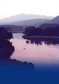
Map 3 ~ Moore ReservoirPrinter friendly map. Below the Gilman Dam, the river is too shallow
for motorized boating until it spills into the vast
and beautiful expanse of Moore Reservoir. Impounded
by the massive 178’ high Moore Dam, Moore
Reservoir at 3500 acres is actually New
Hampshire’s fourth largest lake, and its
largest undeveloped lake. Thanks to a recent
agreement between the hydro power company, federal
and state agencies, conservation groups, and the
CRJC, the reservoir will stay that way, to remain
open for wildlife habitat, water quality
protection, and public recreation. The state line
is inundated here, and much of Moore Reservoir is
actually Vermont waters. No overnight camping is allowed on Moore Reservoir. The power company advises that vehicles left in its parking areas after closing will be towed at the owner's expense. Boaters can help keep the Moore experience a good one by practicing “carry in / carry out” and parking responsibly.. During the boating season, expect that water levels could vary up to nine or ten feet. Watch for changes in water level Make no mistake about underwater boating hazards. The water level fluctuates as power is generated, and may bring logs, shoals and rocks within propeller range. Boaters should give as wide a berth to shallows and submerged rocks as they do to canoeists and other small craft. Wind-driven waves, boat chop, and floating debris can also be a threat on this big piece of water. If you don’t know the area, use special caution. Personal watercraft must stay 300' from shore or other boats or islands. Anglers will find trout, northern pike, land-locked salmon, pickerel, perch, and bass. Don’t be surprised to find an osprey or a bald eagle fishing, too. Marine Patrol: Toll Free in NH (1-877-642-9700) or 603-293-2037. For the safety of all, please call if you observe illegal or dangerous boating activity. Information on current and projected flows at Connecticut River mainstem dams is available through TransCanada Hydro Northeast. |
