![]()
![]()
![]()
![]()
![]()
![]()
![]()
![]()
![]()
![]()
![]()
![]()
![]()
 Map 10 ~ Weathersfield Bow RegionPrinter friendly map
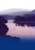
Watch your wake! In recent years, erosion from boat wakes and wind-driven waves threatened to destroy a section of nearby riverbank which held the remains of a very early Indian village. Glidden Island has now eroded completely away, some say as a result of heavy use by waterskiers. This is often a problem area for boating, and boaters’ help in minimizing conflicts is appreciated.The river is too narrow for legal use of ski craft above the Ascutney Bridge. There is a public access for cartop boats just upstream of the Ascutney Bridge, on the NH side, that is not marked on the map at right. The trail, reached from Route 12A, is the former approach to the previous bridge, and the path to the river is narrow and very steep. Be sure to check your boat for exotic milfoil before and after your visit to the river at Hoyt’s Landing. For boating services, look for Green Mountain Marina on the river in Rockingham, north of Herrick’s Cove. At Charlestown, look for the stockade of the reconstructed Fort at No. 4. In 1745, this was the northernmost settlement on the Connecticut River. The bass and walleye fishing in this part of the Connecticut River is becoming legendary. Information on current and projected flows at Connecticut River mainstem dams is available through TransCanada Hydro Northeast. Marine Patrol: Toll Free in NH (1-877-642-9700) or 603-293-2037. For the safety of all, please call if you observe illegal or dangerous boating activity.
|
 Shallow
water usually keeps power boats from traveling
upstream of the Ascutney bridge, and waterskiing is
not recommended upstream of this point due to the
width of the river and susceptibility to
erosion.
Shallow
water usually keeps power boats from traveling
upstream of the Ascutney bridge, and waterskiing is
not recommended upstream of this point due to the
width of the river and susceptibility to
erosion.