
Region Maps
Headwaters Region Maps:
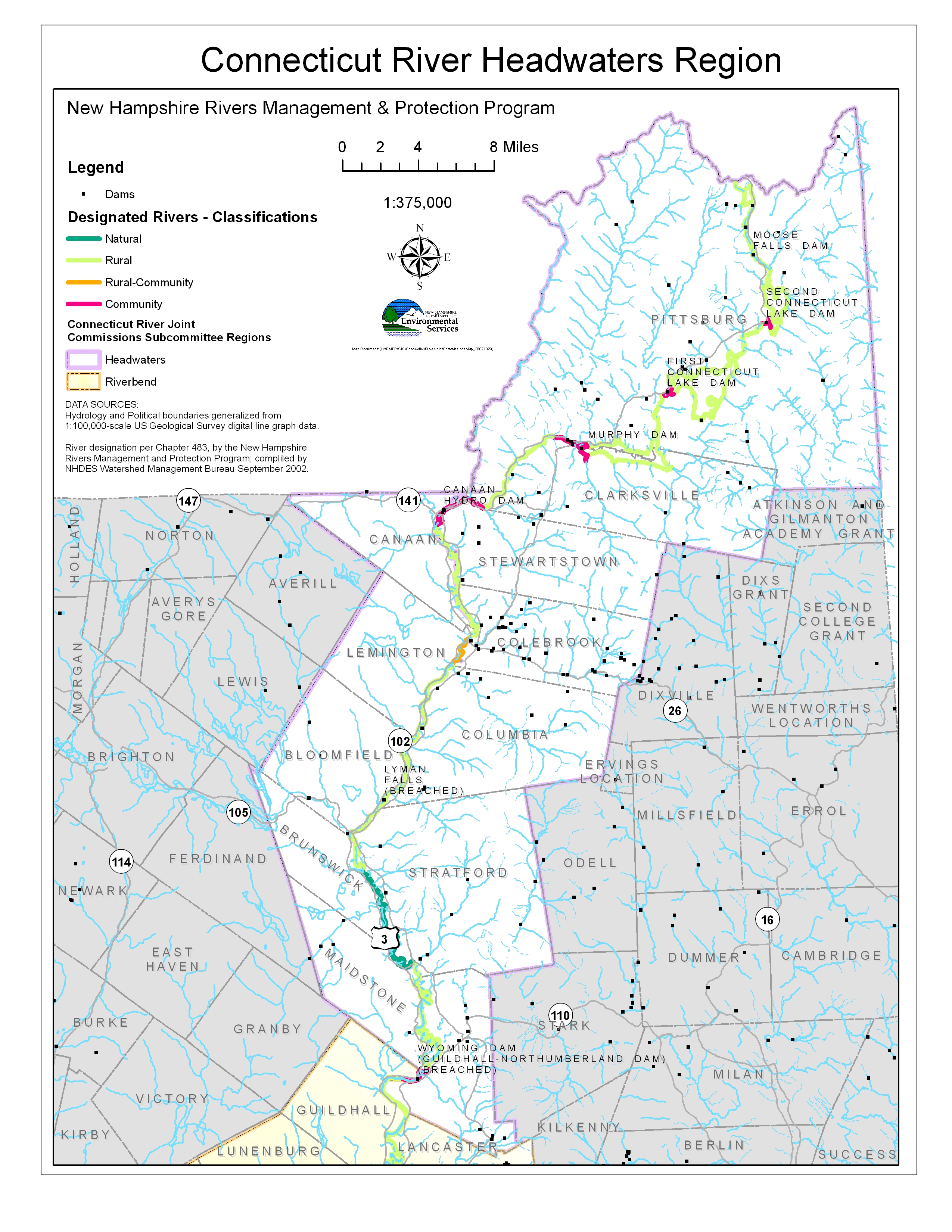
- Map of the Headwaters Region with river segment designations
- Maps of riverbank stability and bank composition
- Boating maps
- Water Resources maps for individual Headwaters Region towns:
Vermont New Hampshire Canaan Pittsburg Lemington Clarksville Bloomfield Stewartstown Brunswick Colebrook Maidstone Columbia Stratford map data sources Northumberland
Riverbend Region Maps:
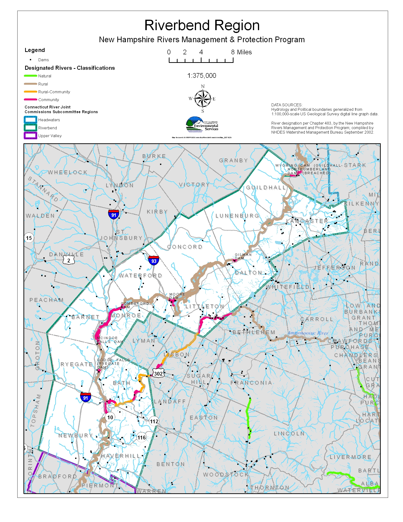
Riverbank stability and bank composition (Lancaster, Lunenburg, Dalton)
River segment designations in the Riverbend Region
Water Resources maps for individual Riverbend Region towns:
| Vermont | New Hampshire |
| Guildhall | Lancaster |
| Lunenburg | Dalton |
| Concord | Littleton |
| Waterford | Monroe |
| Barnet | Bath |
| Ryegate | Haverhill |
| Newbury | Map data sources |
Boating and river access:
- Lancaster and Guildhall
- Gilman and Moore Reservoir (Lunenburg, Dalton, Concord, Waterford, Littleton)
- Lower Fifteen Mile Falls (Waterford, Littleton, Barnet, Monroe, Ryegate, Bath)
- Woodsville/Wells River (Ryegate, Bath, Newbury, Haverhill
Upper Valley Region Maps:
River segment designations in the Upper Valley
Water Resources maps for individual Upper Valley towns:
| Vermont | New Hampshire |
| Bradford | Piermont |
| Fairlee | Orford |
| Thetford | Lyme |
| Norwich | Hanover |
| Hartford | Lebanon |
Boating and river access:
Mount Ascutney Region Maps:
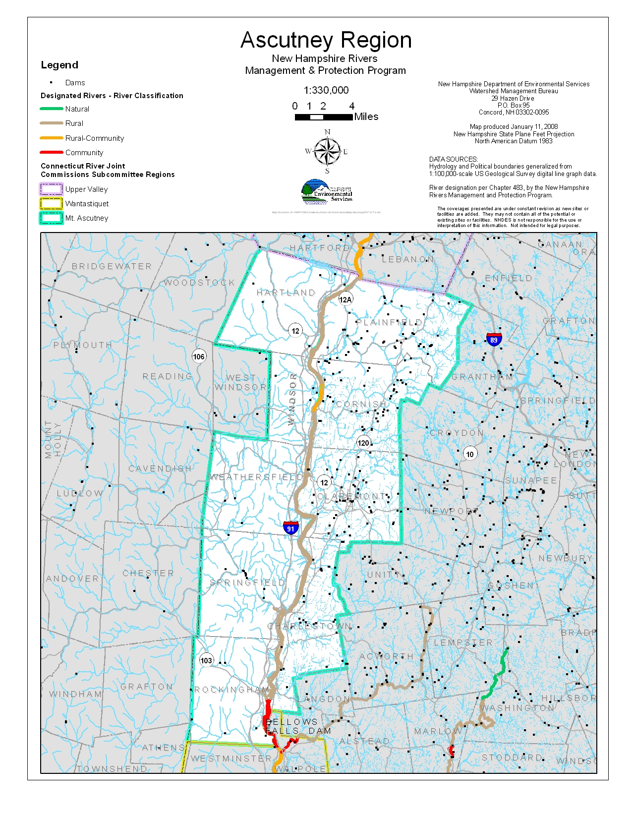
NH Segment designations for the Connecticut River in the Mt. Ascutney region
Water resources in each town:
| Vermont | New Hampshire |
| Hartland | Plainfield |
| Windsor | Cornish |
| Weathersfield | Claremont |
| Springfield | Charlestown |
| Rockingham | map data sources |
Boating maps of the Mt. Ascutney region:
- Hartland/Windsor/Plainfield/Cornish
- Weathersfield/Springfield/Claremont/Charlestown
- Springfield/Rockingham/Charlestown/Walpole
Wantastiquet Region Maps:
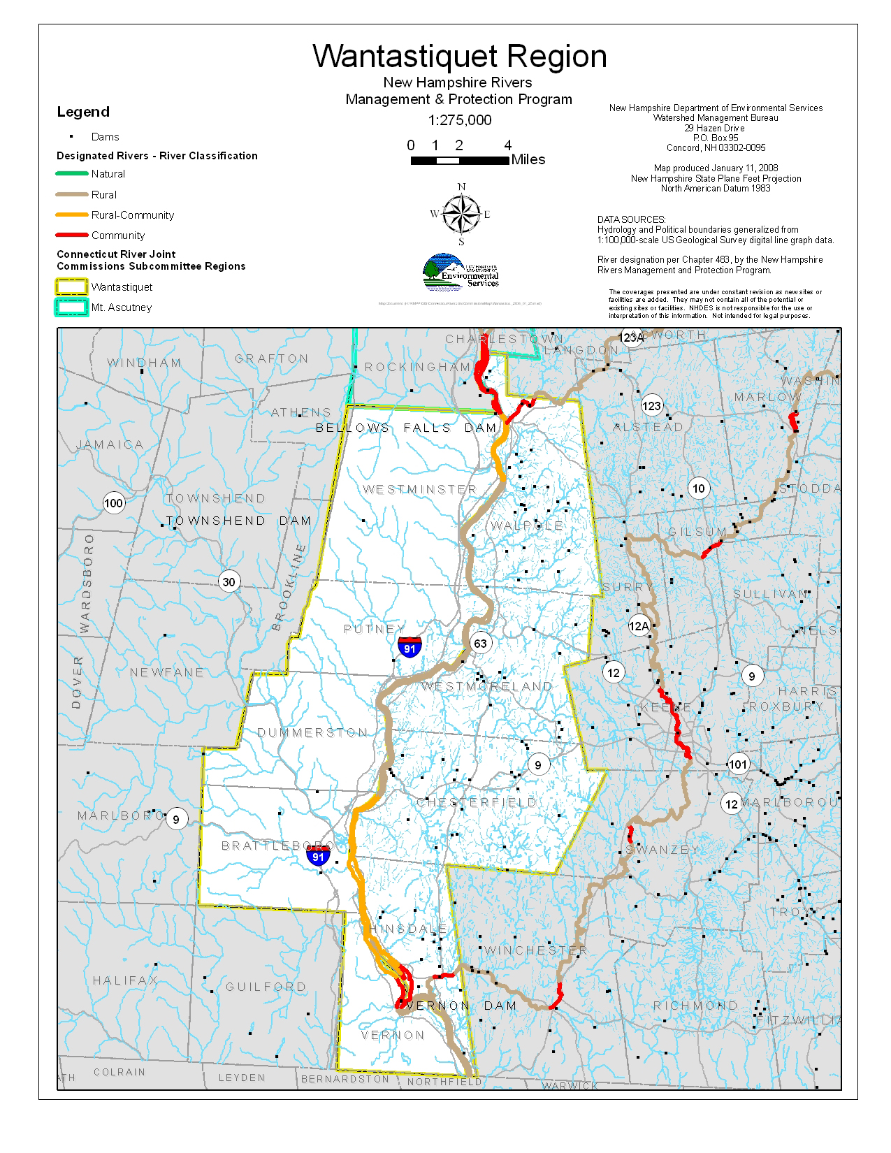
River segment designations in the Wantastiquet Region
Water Resources maps for individual Wantastiquet region towns
| Vermont | New Hampshire |
| Westminster | Walpole |
| Putney | Westmoreland |
| Dummerston | Chesterfield |
| Brattleboro | Hinsdale |
| Vernon | map data sources |
Boating and river access: