
Issue: All across the country, and right here in the Connecticut River Valley, over the last 25 years, people have experienced the increasing benefits of a commitment to pollution control and water quality. Billions of dollars have been spent by government and industry on wastewater treatment, and billions have been gained in real estate value, tourism, outdoor recreation, and public health. Architect of these achievements is the federal Clean Water Act, a law whose goals have shaped the expectations of a generation. The law's aim of no water quality degradation still challenges us today.
As directed by Section 305(b) of the federal Clean Water Act, Vermont and New Hampshire have prepared statewide assessments of water quality and have reported to Congress every two years since 1976. Vermont and New Hampshire cooperated in 1992-4 to prepare a special bi-state Connecticut River watershed report for the Connecticut River Joint Commissions. Written for the interested public, it answers commonly asked questions about water quality and uses of the mainstem and tributaries in the CRJC's five local river subcommittee regions. In preparing this report, the water quality agencies for both states had an opportunity to explore the significant differences that exist in their approaches to water quality assessment. These differences are both philosophically and legislatively based.
In general, New Hampshire's approach until recently was to assess water quality based upon chemical, physical, and bacteriological sampling at fixed locations, and did not include biological monitoring. The sampling was traditionally done during lower flow summer months. The results are compared with New Hampshire Water Quality Standards established by the New Hampshire Department of Environmental Services (DES) and the New Hampshire legislature, which allow limited professional judgment determinations by DES personnel, who identify violations of the standards in a pass/fail fashion.
Vermont's approach is to assess water quality based on data collected as part of permit and enforcement actions, ambient biomonitoring data (assessment of life in the river), public comments, and the judgment of state and federal water resource professionals. Chemical and bacteriological sampling is limited. Benthic macro-invertebrate (bottom-dwelling stream insects) and fish sampling of stream reaches is performed at fixed stations. Based on available data and with comparison to the Vermont Water Quality Standards, assessment determinations are made which reflect existing problems as well as threats to water quality due to point and nonpoint pollution sources.
Opportunities: The Federal Clean Water Act, which set a policy goal of "swimmable, fishable" waters and charged the states with adopting water quality standards, is the primary reason why the Connecticut River is clean today. Maintaining a strong Clean Water Act and effective state implementation are vital to the water quality progress that must continue.
1. The Congressional delegation and everyone who cares about clean water should support reauthorization of a strong Clean Water Act that does not compromise improved water quality.
2. Vermont and New Hampshire should develop a common policy and water quality standards that include biological, physical, and chemical components to ensure a healthy river.
3. The health and future of tributaries to the Connecticut River should be examined, since these waters influence the quality of the mainstem. Citizens living along tributaries should develop protection plans for their rivers.
Issue: Water quality monitoring is invaluable in detecting problems and in measuring the progress of cleanup, as has been well demonstrated at Morris Brook in Haverhill. Here, the owner of a dairy farm undertook a major cost-shared project to control non-point pollution in the stream which flows through his property. Monitoring of the stream by Connecticut River Watch Program volunteers and staff before, during, and after the project showed not only that the work had markedly reduced pollution from the farm, but also that biological monitoring, a method used routinely by Vermont but not until recently by New Hampshire, was important in detecting the healthy change in the stream that resulted from the farmer's efforts.
Until 1994, the states were also able to rely upon extensive water quality monitoring performed in the Connecticut River basin by the Connecticut River Watch Program. This non-profit volunteer-based program of the River Watch Network operated in the watershed since 1988 but is currently inactive due to the absence of sustained funding.
Opportunities: Water quality monitoring is one of the keys to pollution prevention, and should be encouraged widely within the basin, by providing adequate organizational assistance and support. Monitoring is particularly useful on tributary streams where localized sampling can more easily identify sources of trouble.
1. Vermont and New Hampshire should develop a coordinated, collaborative approach to monitoring the quality of the river for human use and ecological health. Specific information needs should be spelled out. This monitoring should involve both various levels of government and citizen groups, each gathering information appropriate for their resources and interests. Vermont and New Hampshire should share information regularly and develop guidelines on data quality control and confirmation.
2. Monitoring river ecosystem health should include indicators of physical, chemical, and biological processes, using a full range of techniques from simple observations to more detailed sampling and analysis of water quality and aquatic life, habitat quality assessment, and monitoring of the physical channel. Each state should broaden its respective sampling approach to include all indicators and a full range of techniques. Benchmarks can be established in state water quality standards or set for specific sites.
3. State agencies should evaluate site specific chemistry data within impoundments to document dissolved oxygen and the extent of algal problems. To ensure that water quality requirements of both states are met in interstate waters, the states of New Hampshire and Vermont have agreed to coordinate their respective 401 certificate reviews with a goal of consistent conditions and monitoring requirements.
4. Local citizen groups, non-profit organizations, and schools should monitor the quality of their neighborhood streams, both for the educational opportunity it represents, and to contribute to the knowledge about our river system. Organizational support is available from the River Watch Network and the states. We particularly hope that such efforts will begin in the Headwaters and Riverbend regions, areas where formal programs on the mainstem do not yet exist, and where water quality holds proven economic importance in the recreation and tourist industry. The permission of the landowner should always be obtained before crossing land to monitor a waterway.
5. Volunteers should consider using the bi-state 1994 Connecticut River Water Quality Assessment as a guide to help focus their initial efforts on locating pollution sources. A Citizen's Guide to River Monitoring in the Connecticut River Valley, produced in 1995 by the River Watch Network for the CRJC, will assist people in establishing long-term, community-based, and scientifically credible river monitoring programs here.
6. Local decision-makers should be made aware of the results of water quality monitoring and consulted in actions taken. Appropriate state agencies should be contacted if the results do not meet state water quality standards.
7. Volunteer water quality monitoring programs need both citizen and financial support, and useful contact with state agencies. These agencies should continue to provide monitoring groups and local decision-makers with a better understanding of how on-going state water quality assessments are made and how local citizens can contribute information. New Hampshire's proposed Volunteer River Assessment Program offers an excellent opportunity for Connecticut River Valley people to participate in understanding and improving the health of their rivers and streams.

Issue: The discovery in 1988 of cadmium, chromium, and PCBs in the tissue of fish sampled in the Connecticut River from West Lebanon to Brattleboro, is strong cause for concern. The New Hampshire Department of Public Health issued a statewide recommendation in December, 1994 that fish consumption be limited due to mercury content. Whether toxic substances are entering fish from present discharges to the river or from riverbottom sediments contaminated long ago is unknown. The levels of toxicants discovered in the 1988 study are enough to interfere with fish reproduction and growth, and since these toxics accumulate in fish tissue, contaminated fish could be dangerous not only for the animals who eat them, such as eagles, mink, and osprey, but also for people. Fish tissue sampling is expensive, but human health and the health of the river ecosystem are even more precious.
Opportunities: The river's return to health means that people once again enjoy fishing the river for sport and for food, both in solitude on a backwater at sunset or as part of the increasingly popular tournaments which draw fishermen from all over the Northeast. Fish should be safe to eat. Much more information is needed to reassure people about the health and future of fish populations, and to help identify sources of contamination. The presence of toxic substances in the Connecticut River and its tributaries remains largely unknown. We need help in looking more closely at fish tissue toxicity throughout the river, not just where toxics were found in the past, and in tracing and addressing possible sources of these contaminants.
1. State and federal agencies should fund the monitoring for toxic substances in the water, fish, and sediments, and inform the public about the results.
2. Where problems such as copper-mine runoff in the Ompompanoosuc River watershed in Vermont are documented, the states and federal government should place a high priority on remediation.
3. All consumers should limit their consumption of all species of Connecticut River fish, according to the New Hampshire Department of Public Health. Choose younger, smaller fish, remove the skin and fatty areas, and bake or broil the fish instead of frying. Women of reproductive age and young children should limit their consumption to one meal per month, and others should limit to four meals per month.

|
|
Issue: Nonpoint source pollution is contamination that cannot be traced to a single source such as an effluent pipe. Nonpoint sources produce pollution in a diffuse manner. The key to maintaining or improving water quality most often lies in the hands of private landowners and towns. Studies show that urban land, including roads, construction sites, houselots, and other development, contributes more than twice as much pollution per acre as farmland. With the high percentage of agricultural land along the river, however, the use of best management practices ("BMPs") by farmers holds the greatest potential for reducing nonpoint source pollution in the mainstem. |
|---|
Use of best management practices can also help towns, utilities, and landowners avoid harm to public waters. This includes cautious use of pesticides and herbicides. The small family farm is now sharing our watershed with a growing number of larger farms, where good management is the key to avoiding water quality problems when more animals are kept on the same piece of ground.
Unfortunately, some BMPs can carry a high price tag. For example, construction of adequate manure storage pits is costly, but frees a farmer from the temptation to dispose of surplus manure on frozen fields at a time when it cannot fertilize them and the bacteria and nutrients it contains are likely to be washed into a nearby stream. Farms are a frequent suspect in nonpoint pollution of rivers and streams, and such winter spreading without an emergency exemption is a violation of Vermont acceptable management practices, and is discouraged by New Hampshire. Farming is also a threatened way of life and land use in the Connecticut River Valley, and every dollar spent upon fertilizer must count. The costs of controlling nonpoint pollution can occupy a painfully prominent place on a farm's balance sheet.
|
|
A recent pilot program in Grafton County has gathered many new believers in the farming community, who found that they could save thousands of dollars each year in fertilizer costs with custom-fit nutrient management plans for their farms. By knowing the precise capabilities of their soils, the nutrient needs of their particular crops, and their crop-handling styles, farmers could apply the right amount of the right fertilizer at the right moment, and know that it would go directly into their crops and not into the river. This is a win-win approach to benefit both the farmer and the river, that can bring both economic and environmental gains. A commitment of public dollars was needed to launch the Grafton County effort, and would be appropriate elsewhere. |
|---|
Opportunities: A riparian buffer is probably the single most important hedge against nonpoint pollution. The states have also prepared guidance for a wide range of topics to help landowners and towns avoid polluting waterways. These include BMPs for agriculture, timber harvesting, construction and development, care of septic systems, road construction, road salting and dumping, golf courses, site excavation, sand and gravel operations, urban runoff, chemical and petroleum products, land application of biosolids, and docks, moorings, and marinas. Two publications by the CRJC offer ready ideas: A Homeowner's Guide to Nonpoint Source Pollution Control in the Connecticut River Valley, and A Watershed Guide to Cleaner Rivers, Lakes, and Streams (see Appendix D).
The real public benefit of good water quality, and the need for a private landowner's use of best management practices to protect that benefit, make it appropriate that the public help share the cost of the more expensive measures, such as the manure storage facilities some of our farms still need.
1. Towns should demonstrate their commitment to protect their waterways. Planning boards and commissions should require developers to observe best management practices for sediment and erosion control during and after construction. All should attend carefully to stormwater management when reviewing plans for new development that includes significant impervious surfaces such as parking lots and roofs. New Hampshire towns should require developers to apply for a DES Site Specific Permit if they are disturbing more than 50,000 contiguous square feet of land within protected shoreland, and consider adopting the actions recommended by A Watershed Guide to Cleaner Rivers, Lakes, and Streams. Town road crews should dispose of snow wisely in accordance with state and federal laws and use salt sparingly, especially near surface waters.
2. Homeowners, farmers, loggers, and others who can affect the land can demonstrate responsible use of it by learning about and using best management practices. Landowners should take advantage of the expertise and support of the federal Natural Resources Conservation Service (NRCS), the Cooperative Extension Service, the Farm Services Agency, and state agencies, among others. Everyone must practice the state of the art in managing land, both publicly and privately.
3. The U. S. Department of Agriculture (USDA) should support its Natural Resources Conservation Service, Cooperative Extension Service, and the conservation districts in working with valley farmers to prepare a custom nutrient management plan for each farm. The Cooperative Extension Service offices in each state should work together for the benefit of valley farms.
4. Farmers and other landowners should explore the many possibilities offered by the 1996 Farm Bill's Environmental Quality Incentives Program (EQIP) to help them make effective use of their land while safeguarding water quality.
5. The CRJC should work with the NRCS to develop a bi-state proposal for EQIP projects in the valley, based on recommendations by the local river subcommittees working with the local conservation districts, who are familiar with the needs of local farmers and other landowners.
6. All landowners, from utilities, the railroad, and large corporations to farms and private homeowners, should use extreme care with pesticides or herbicides. Select the least toxic substance, keep it away from surface waters and neighboring property, and dispose of it properly.
Issue: Naturally vegetated riverbanks are the river's original defense against nonpoint pollution and erosion, and no one has yet come up with a better invention. Since the retreat of the glacier, willows, maples, shrubs, grasses, and other hard and soft-stemmed plants have specialized in surviving here and are key in riverbank and water quality protection. They provide habitat while their roots fight the river to anchor the soil. Most of the time they win the battle. Today we appreciate the scenic quality of an undisturbed riverbank and are glad for the screen this vegetation provides, both to shield nearby development from the view of river recreationists, and to provide privacy for those who live near the river.
More than window dressing, a riparian buffer of vegetation actually protects the quality of water entering the river by filtering out and trapping sediment and pollutants carried by runoff. Studies show, for example, that the amount of nitrogen in runoff and shallow groundwater can be reduced by as much as 80% after passing through a streamside forest. Riparian forests are well adapted to inundation and are effective in slowing floodwaters and reducing downstream erosion.
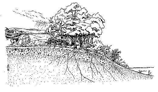
The problem is that much of the river's natural riparian forest is long gone, removed for farming, timber harvesting, development, or improvement of a homeowner's view of the river.
Reestablishing a riparian buffer can amount to leaving the riverbank alone to revegetate itself naturally. This is problematic for farmers, however, who know that for every mile of riverfront, 100 feet set aside for a buffer means twelve valuable acres taken out of production. Forested buffers can also shade crops. A buffer of shrubs will provide most of the erosion and pollution control benefits of a forested buffer without shading crops and will help keep the farmer's bank intact and his equipment out of the river.
Opportunities: This single tool, the riparian buffer, is the most cost-effective means which nearly every landowner can use to do good things for the river and its inhabitants. Riparian vegetation has become better adapted through the centuries to handling the river's whims and rhythms than any form of riverbank management humans can devise. Riparian forests in particular offer the best possible trap for pollutants and sediment washing off the land, and the best habitat for migrating and resident wildlife.
1. Landowners should leave riparian buffers undisturbed where they remain, and allow them to return wherever possible, to provide the best pollution filter and trap.
2. USDA programs should support farmers and other eligible landowners in establishing riparian buffers. Compensation for landowners is appropriate to encourage buffer protection. Farmers should consider allowing growth of shrubby buffers as an alternative in areas where trees could shade crops.
3. Towns should consider requiring the maintenance of an existing natural woodland buffer within at least 150 feet of the river. Steeper land, erodible banks, and more intensive land uses warrant wider buffers to do a proper job, particularly where runoff drains directly toward the river.
4. Owners of paved areas near waterways should make special efforts to plant and encourage buffers of vegetation to trap parking lot debris and prevent pollutants from washing into the water, and to screen the view of parking lots from the river.
5. Protection of riparian buffers should be a part of any conservation easement on riverfront land.
6. As town planning boards and commissions consider shoreland protection, they should adopt riparian setbacks for development and to protect riparian forests.
Issue: Stormwater runoff is one of the unfortunate results of development and urbanization. Every roof, parking lot, and other impervious surface collects water that is channeled away, and every new road or driveway is ditched to do the same. The result is increased runoff into waterways each time it rains. Besides the increased chance of flooding and associated erosion, the runoff carries whatever pollutants it picked up on the way.
When many municipal wastewater treatment systems were built, they were connected to collection systems for stormwater as well as for sewerage. In some communities, storm drains are connected to their facility in such a way that enough water can enter the wastewater treatment plant during a heavy storm to overwhelm the plant, and cause it to discharge untreated sewerage. Separating such a combined sewer overflow ("CSO") is a very expensive project, and the towns and states have been working together for some time to deal with this problem. There are several cities which still have CSOs that may be responsible for pollution during and after storms. These are St. Johnsbury (whose discharges to the Passumpsic River enter the Connecticut River), Springfield (discharging to the Black River) and Lebanon (discharging to the mainstem). CSOs pose a threat to human health which we cannot afford to ignore, especially now that the river has once again become popular for swimming and boating.
Opportunities: Congress can provide much-needed, targeted assistance to local communities through a rejuvenated Clean Water Act.
1. The states should seek federal assistance on behalf of the towns to remedy combined sewer overflows as quickly as possible. Combined sewer overflow separation projects should also consider treatment of stormwater where possible. Treatment of the initial ten to fifteen minute pulse of stormwater from urban streets, lawns, and buildings would significantly reduce the impacts of pollutants carried in urban storm water.
2. The New England Interstate Water Pollution Control Commission can promote this need as a worthy candidate for funding under a newly-reauthorized Clean Water Act.
3. Community planning boards and commissions should ensure that stormwater is managed and treated as development occurs, and require developers to prepare a stormwater management plan. This is perhaps the most easily implemented opportunity in nonpoint pollution prevention.
|
|
Issue: Modern society has created a surprising set of potential fertilizer sources. Pulp and paper mills produce short-fiber paper sludge. Wood-burning energy plants produce wood ash. Human waste products end up in septic tanks as septage or in municipal wastewater treatment facilities as sludge. Those sludges intended for land application are stabilized by reducing pathogens such as bacteria and viruses, and are then called biosolids. Proper handling and disposal of all of these residues is an expensive and perplexing problem. They need to go somewhere, but simply piling them into precious landfill space is a costly solution. |
|---|
Some sludges, wood ash, and other residues can be a good source of nutrients and organic material, and offer a way for farmers to shave their fertilizer budget while recycling. Like any fertilizer, however, they can end up producing algal blooms in surface waters if they are misapplied or wash off the land before they can be used by growing plants. Landowners receiving sludges or biosolids are required by the states to have a management plan prepared for each field to ensure that soils are not over fertilized, to prevent contamination of ground and surface waters.
Sludge offers both benefits and risks. Benefits include water holding properties, organic content for better soil texture, and value as a slow release fertilizer. Not all of these materials are created equal. Grade A biosolids, in which pathogens are below detectable levels, are not as closely restricted by federal and state regulations. Grade B biosolids may still contain detectable pathogens even after treatment such as with lime, and may have higher metal concentrations, but may be used when site and crop restrictions are followed to reduce the risk to public health. While some residues are relatively odor-free, others can be a real nuisance, and can be noticed a long distance from the application site, unless the material is quickly incorporated into the soil or further treated.
|
|
Biosolids are much more than simple processed human manure. The problem is that anything that goes down the drain winds up in either a treatment plant or septic system. People sometimes pour household chemicals and used motor oil down their drains. Treated industrial wastes containing chemicals and metals such as mercury and cadmium, that are hazardous to human health, may be discharged into municipal plants. If the required pre-treatment is not effective, then the resulting sludge may contain elevated heavy metals and chemicals which may be unacceptable for agricultural land application, and these are usually landfilled. Sludges which contain less than the limits allowed for the ten metals addressed by the federal rules are available for land application, and offer a cost savings to the city or town and to the receiving landowner. |
|---|
Many of the metals and chemicals that are sometimes found in sludge are either harmless, remain firmly locked in the soil, or dissipate over time. Others such as mercury, PCBs, and dioxins tend to accumulate in natural food chains, and could concentrate in the bodies of predatory fish, birds, and wildlife. Northern New England's frequently acidic soils may allow heavy metals to move from the earth into plants and waters if soil pH is not artificially maintained above 6.0. Maintaining this pH is a management practice which farmers also follow for maximum crop yield, but on many soils it also requires long-term effort and vigilance. If agricultural activity should cease and the farm is sold for residential development, or should planting change to an acid-loving crop such as blueberries, previously locked up metals from sludge could begin to move through soils, water, and plants.
Sludges from paper plants may contain chemicals such as cancer-causing dioxins, that are potentially harmful to both humans and wildlife. As of this writing, Vermont has regulations limiting the content of dioxins and similar contaminants in material to be land-applied. Federal and New Hampshire policy is to look to "guidance" levels for these contaminants. Current federal and state regulations are aimed at protecting human health, but less is known about tolerable metal and chemical levels for fish and wildlife.
While landowners and others are beginning to understand and learn how to handle biosolids, some wonder why there is so much concern about cycling these materials into our soils, when pollutants already lurk in the unlined landfills often located near waterways, and are delivered to New England every day on the southwest wind.
A sensible use of sludge may be to revegetate and close landfills and other highly disturbed pieces of ground. A second look is worthwhile when using biosolids to close gravel pits, however, since where there was gravel, there is often groundwater below. Safe drinking water depends upon clean aquifers.
The federal government has enacted regulations to address health effects, odors, and soil and water contamination. Both Vermont and New Hampshire have regulations controlling the application of septage, sludge, biosolids and wood ash. These regulations require soil and sludge testing, use of field/farm specific management plans for nutrient and metal loading, detailed odor control plans, setbacks from roads, abutters, and waterways, and public notice of meetings.
As industries and communities seek cost-effective and environmentally sound ways of dealing with these materials, they are frequently approaching landowners in the Connecticut River Valley for permission to spread various residues on farm land. Some of the biosolids have come from more heavily industrialized states, and often towns and landowners are concerned about their content and pollution potential, particularly when each load is not tested before it is applied. Land application is supportable only if handled responsibly and is performed under federal, state and local oversight.
Opportunities: Recycling of nutrients through land application offers a useful way to utilize some of these materials, reduce fertilizer costs to landowners, rebuild soils, and save space in landfills. However, until harmful substances contributed from both household and industrial sources are effectively removed from the waste stream and an unpolluted, substantially pathogen-freed source of human waste is available, there will always be some risk involved in land application of biosolids and sludge. Perhaps insurance is appropriate to protect farms in particular against this risk.
The public's growing sensitivity toward environmental quality over the last two decades is understandably aroused over this topic. The public deserves the reassurance that further testing and monitoring would provide.
It is essential for all concerned to work together toward a goal of "clean," safe biosolids, and that rules be consistent among neighboring states to prevent one from accepting waste that another one deems unsafe. Technologies such as composting and anaerobic digestion are showing promise for increasing the safety of recycled wastes, and warrant close attention. There is also still much to learn about the materials themselves.
|
|
1. New Hampshire and Vermont should continue to provide effective and consistent oversight of the disposal of septage, sludge, biosolids, and wood ash, and ensure that best management practices are followed and enforcement actions taken where appropriate. The legislatures should ensure that their state agencies are adequately funded to carry out this responsibility. 2. New Hampshire and Vermont should ensure that landowners are provided with specific, timely, and accurate information on the source(s) of the residues and their content, especially of nutrient value, heavy metals, and any potentially harmful constituents.Random testing of individual loads, particularly from out-of-town sources, would greatly increase public confidence in the safety of land application. |
|---|
3. Landowners must take full responsibility for use of these materials on their land. They should consult with their lending institutions before accepting biosolids or other residues.
4. The generator of the residue should take the major portion of liability for future concerns about contamination of soil and water on the property where sludge has been applied.
5. The states as well as the federal government should continue to research issues regarding land application of these residues, to assure public health protection and pollution prevention. They should continue to evaluate the effects of exposure through multiple pathways, migration of toxic materials through natural food chains, and the wisdom of spreading these materials in floodplains.
6. New England Interstate Water Pollution Control Commission should assist the states in working toward consistent contaminant level limits, to provide uniform protection, and to avoid attracting wastes produced elsewhere to one particular state. These limits must include dioxins and similar substances of concern. Metal loading limits should respond more closely to natural soil pH of receiving sites.
Issue: Riverbank erosion is one of the most prevalent and misunderstood problems on the Connecticut River and its tributaries. Landowners from one end of the river to the other are concerned about losing their land to erosion, and perhaps about paying taxes on acres that may now be out of town, gone downriver. Often they wonder whom they should blame. Fisheries and water quality experts worry about loss of fish spawning habitat and pollution from sedimentation. The Connecticut River can and does erode valuable agricultural soils and threatens roads and buildings. However, some attempts to stop erosion can have unintended effects, and can actually start erosion somewhere else, on someone else's property. The CRJC have recently published The Challenge of Erosion, a series of information fact sheets designed to help landowners better understand and work with this complex river process.
It is the nature of rivers and streams to change course. Erosion occurs both on free-flowing rivers and on dammed rivers whose water levels fluctuate according to how the dams are operated, and the role of impoundment fluctuations on riverbanks is a topic of continuing debate. People cannot stop erosion - they can only speed it up or slow it down. There are many contributing factors to erosion, and people can influence only some of them. The most important deterrents are minimizing the attack on vulnerable banks from the water and from the shore, and allowing the banks to naturally fortify themselves with a protective buffer of vegetation.
People place their homes and businesses in danger if they build them too close to the river on erodible ground. The federal government spends millions of taxpayer dollars nationwide each year in disaster relief for damage to structures which may have been unwisely built within a river's eventual path.
Opportunities: People living, farming, and doing business near the river should understand how a river works. Avoid setting up an erosion-prone situation in the first place.
|
|
1. Landowners should help protect their banks and water quality at the same time by maintaining or planting a buffer of vegetation along streambanks, particularly where the land slopes toward the waterway. Such a buffer will also ensure their own privacy. They should keep heavy equipment, livestock, foot traffic, and structures off erodible riverbanks. Along their impoundments, dam owners should also cooperate with landowners to arrest erosion and provide buffers. 2. When designing stabilization for a problem site, use native vegetation wherever possible to achieve a natural solution to bank erosion which has many benefits beyond simply holding the bank together. Avoid armoring the bank with stone riprap and other "hard" engineering solutions unless as a last resort when erosion immediately threatens a road or other large investment, since riprap is now understood to be a less preferable alternative for bank stabilization. Maintaining a vegetated riparian buffer should be a part of any river and streambank restoration project and conservation easement on riparian land. |
|---|
3. Anyone faced with an erosion problem should contact professionals such as the Natural Resources Conservation Service for help in evaluating which solution, if any, is the best for the site, since each site is different and requires a practiced hand.
4. Recognize that often the best choice is to leave the site alone and let the river take its course.
5. Towns should contribute to controlling both erosion and property damage by discouraging construction too close to the river or within the floodplain. Activities in this sensitive area should be limited to agriculture, recreation, forestry, and wildlife conservation.
6. Towns should develop a maintenance and management plan for culverts and other potential erosion sites.
7. Boaters should obey existing speed laws and watch their wakes to be sure that they do not strike the bank with erosive force.
8. The New Hampshire legislature must provide sufficient funds to allow New Hampshire Department of Safety's Marine Patrol to adequately enforce existing speed laws on the river.
9. Dam owners should thoroughly evaluate impacts of impoundment cycling on riverbank erosion as part of relicensing studies, and undertake mitigation as appropriate.
10. Federal and state agencies should fund vegetative stabilization demonstration projects.
11. Anyone contemplating work on a riverbank must obtain the proper permits before going ahead.
Issue: The Connecticut River, the largest in New England, gathers the rain and snow falling on the 11,250 square miles of its watershed in New Hampshire, Vermont, Massachusetts, and Connecticut. This precipitation rarely arrives in predictable doses, and moves in pulses down the river that reflect both the amount of rainfall and the ability of the watershed to soak it up.
The river requires its full floodplain for storage during high water. Wetlands and floodplains are where the river naturally stores floodwater and relieves the water's energy. The Connecticut River's broad floodplain, famous for its fine agricultural soils, has become key waterfront property now that the river is clean and attractive once again. Development of all kinds, from industry and commerce seeking large expanses of flat, open land, to houselots to be marketed for their river views, competes increasingly with agriculture for room on riverfront lands. Flood levels are not the same from year to year. Few people remember those times when the worst possible combination of weather and river conditions produced catastrophic floods. In 1938, many riverfront towns were ten or twenty feet underwater.
During the middle of this century, the U.S. Army Corps of Engineers built 16 flood control dams on tributaries of the Connecticut in an attempt to reduce the hazard to downstream communities which had grown close to the river. Eventually the cost and public rejection of the concept redirected attention to the concept of natural flood storage, which meant keeping floodplains open and relatively undeveloped. In fact, there is half again as much natural flood storage in the floodplain as there is in all the reservoir areas behind the flood control dams.
The Corps completed its Connecticut River Basin Natural Valley Storage Reconnaissance Study in 1994, and identified two major natural valley storage areas in the upper basin. These are the reach from W. Stewartstown to Lancaster (12,000 acres of floodplain) and Woodsville to Bradford (4,000 acres). The study strongly recommended discouraging development in these flood storage areas, although it concluded that federal purchase or easement acquisition of these areas would be economically unfeasible.
The Federal Emergency Management Agency's (FEMA) Flood Insurance Program prohibits development in the floodway, but permits it in the 100-year floodplain if the developments are "floodproofed." This program does not consider environmental, social, aesthetic, or other relevant values. Most communities considered that this was an adequate way of protecting their citizens from flood damage. Yet simply building a mound for a house site or calling for floodproof design does not solve the problem, it just moves it somewhere else.
Flood maps commonly show the 100-year floodplain, or the area where the chance of flooding in any given year is one percent or greater. Rivers don't read maps or understand statistics, and it is entirely possible that a region could sustain two 100-year storms within a few years, and then not experience another for 200. Few people pay much attention to the 500 year floodplain, which could be inundated by a storm the likes of which might be seen only twice in a millennium. It is important to understand that floodplain maps show only calculated probabilities of flood frequency, rather than lines the river should not be expected to cross. We do not know when these floods could come, but they could well come within our lifetimes, as did the major flooding on the Mississippi River in 1993 when the entire midsection of the country became floodplain once again, including several major cities. The resulting damage to structures built within the floodplain costs taxpayers billions of dollars in disaster relief nationwide.
A town which permits building in its floodplain may be unwittingly contributing to flooding of another town downstream. Only four of the 53 towns along the Connecticut River now specifically exclude construction in their floodplains.
|
|
Most Connecticut River Valley communities developed their approach to flood damage control prior to the vast disaster and flooding on the Mississippi River. The public may have a sense of false security that the many dams on the Connecticut River mainstem and tributaries are adequate to prevent damage from a major storm event, yet several times during the preparation of this plan, at times of year as varied as January and July, the river has carried water high enough to cause significant and prolonged flooding in spite of the best efforts of dam managers to control water levels. The 1996 corn crop in the North Country suffered on soils that were inundated and still had not dried out by mid-summer. Earlier that spring, homes in North Walpole, New Hampshire were threatened as a massive chunk of riverbank washed away. |
|---|
When disaster relief checks come in from the federal government, they can be used to rebuild in the same place if damage is less than 50% of market value, exposing property to damage from the next flood. If the river has been there once, it can return. Only rarely has the decision been made, as in Stratford, New Hampshire, to use the funds more constructively by moving out of the river's way. Unfortunately, the only program offering help to homeowners for relocation has limited funding.
Unfortunately, while most towns are now enrolled in the federal flood insurance program, the maps provided to the towns from FEMA are frequently inaccurate, and cause unnecessary problems for people trying to build or mortgage their homes.
Opportunities: A powerful set of opportunities exists here, in maintaining open floodplains along the Connecticut River. There are both tangible and intangible economic rewards to be reaped by keeping open floodplains in the valley, in addition to the many environmental benefits. If a developed floodplain is a flood disaster waiting to happen, then an open floodplain is taxpayer dollars that stay in the bank. The finest agricultural soils in New England lie within our river's floodplain, and offer an economic return in farm produce that cannot be matched by upland soils and that may well be needed in the future to help feed our region. Once floodplain lands are developed, they are no longer available for agriculture.
The broad floodplains, forests, and open fields along the river are the signature of our valley, the pastoral scenery that draws visitors from all over the world and spells home for us. The growing heritage tourism industry has enormous economic potential for the Connecticut River Valley, and can allow valley towns to capitalize upon the beauty - and flood management potential - of our historic agricultural landscapes and riverfront views.
Floodplain offers a kind of habitat all its own, and the plant and animal communities that specialize in it are highly varied. Ensuring that floodplains remain open for flood control means that they will also remain available for migrating and resident wildlife.
1. Building should not take place within the 100 year floodplain except for agricultural and water-dependent activities. The floodplain should remain open to serve as natural flood storage.If there is no feasible alternative to building in the floodplain, development should be designed so that there is no net fill.Towns should be fully aware of the requirements of flood insurance programs when reviewing proposed development.
2.Towns which still allow building within the floodplain should take a fresh look at this policy and take greater responsibility for flood control, for the safety and welfare of its own citizens and those downriver.
3. FEMA should guide the use of disaster relief funds toward relocating flood-damaged structures whenever possible rather than encouraging rebuilding in the same vulnerable location, and increase funds available through the hazard mitigation program.
4. FEMA should make a priority of working with riverfront towns to be sure that flood hazard maps are accurate and do not present an unnecessary hardship for landowners, local officials, surveyors, bankers, insurance companies, and state and federal agencies.
5. Towns should consider wetlands protection ordinances to help reduce flood damage, among the many values wetlands offer.
Issue: New Hampshire enacted limited protection for lake, river, and coastal shores in 1994 through RSA 483-B, the Comprehensive Shoreland Protection Act. This act applies throughout the state except on rivers like the Connecticut, which were designated into the New Hampshire Rivers Management and Protection Program prior to 1993. On designated rivers, like the Connecticut and Ashuelot rivers, the locally-designed river corridor management plan can be adopted as an alternative. RSA 483-B sets minimum shoreland protection standards for septic system and building setbacks, cutting of woodland buffers, building density, and non-agricultural use of fertilizer next to the waterbody, and prohibits establishment or expansion of salt storage yards, auto junk yards, solid waste, and hazardous waste facilities close to the river. (See Appendix B for further information (Currently unavailable in web form)).
|
|
The land area covered by this act extends 250 feet from the ordinary high water mark, a distance less than the length of a football field. The setback established for buildings is only 50 feet, a distance which may make sense on a relatively stable shoreline such as that of a rocky-bottomed lake, but which is questionable on the bank of a major river such as the Connecticut, which may claim 10-20 feet of territory each year where it is actively eroding. In order for planning boards to implement the Shoreland Protection Act on new development, towns must adopt its provisions into their zoning ordinance. There is no corresponding shoreland protection law in Vermont. Opportunities: The Connecticut River Joint Commissions believe that the Connecticut River deserves at least the very minimum of protection which the New Hampshire Comprehensive Shoreland Protection Act offers. The specific measures should be developed by each local community. The Connecticut River Corridor Management Plan goes far beyond the Shoreland Protection Act in the diversity of means it offers for protecting the river, although not necessarily through new regulations. |
|---|
Regional planning commissions can provide valuable assistance to towns by offering models for shoreland protection on rivers and streams, as well as other ways of incorporating the recommendations of the CRJC and the local subcommittees into town guidance for development.
1. Communities should consult their regional planning commissions to help bring life to the river protection recommended in this Overview and their local subcommittee's plan, by incorporating meaningful standards for development in their town's adopted guidance.
2. Communities on both sides of the river should carefully review the New Hampshire Comprehensive Shoreland Protection Act as a starting point for establishing local measures to protect property and the river.
3. The CRJC believe that a setback of 50 feet for buildings and 75 feet for septic system leach fields (as set forth in the New Hampshire Comprehensive Shoreland Protection Act) is entirely inadequate in situations where the riverbank could become unstable, and urge communities to establish more conservative setbacks to prevent property loss and water contamination. Soil conditions are important to consider because they will determine how leachate will move from a leach field to the river.
4. The State of Vermont should adopt similar if not greater setbacks than those in 483-B for solid waste and hazardous waste facilities, salt storage yards, and auto junk yards, and should encourage its Connecticut riverfront communities to adopt the Connecticut River Corridor Management Plan, which its citizens helped to prepare. Vermont should also review its on-site septage disposal requirements to ensure adequate protection of ground and surface waters.
Previous Part of the Corridor Plan
Next Part of the Corridor Plan